Arunachal scientists gain advanced drone skills at Telangana Aviation Academy
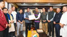
Scientists and engineers from the Centre for Earth Sciences and Himalayan Studies (CESHS), Arunachal Pradesh, have successfully completed an advanced Drone Pilot Training Programme at the Telangana State Aviation Academy (TSAA), a Directorate General of Civil Aviation (DGCA)-certified Remote Pilot Training Organisation (RPTO) at Nadirgul Airfield, Hyderabad.

- Sep 13, 2025,
- Updated Sep 13, 2025, 2:06 PM IST
- CESHS scientists finished five-day drone pilot training in Hyderabad
- Training conducted at DGCA-certified Telangana State Aviation Academy
- Programme supported by Arunachal Pradesh Department of Skill Development
Scientists and engineers from the Centre for Earth Sciences and Himalayan Studies (CESHS), Arunachal Pradesh, have successfully completed an advanced Drone Pilot Training Programme at the Telangana State Aviation Academy (TSAA), a Directorate General of Civil Aviation (DGCA)-certified Remote Pilot Training Organisation (RPTO) at Nadirgul Airfield, Hyderabad.
The five-day certification programme was conducted under the banner of the Department of Skill Development, Government of Arunachal Pradesh. Led by CESHS Director Tana Tage, the team underwent intensive training aimed at enhancing their expertise in drone operations for applications in science, technology, and engineering.
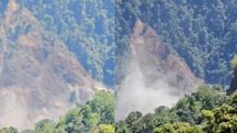
The initiative comes in response to the extensive mapping of critical mineral zones recently identified in Arunachal Pradesh by the Geological Survey of India (GSI). With the completion of this training, CESHS scientists and engineers are expected to significantly strengthen the state’s capabilities in aerial mapping, resource assessment, and data-driven research.
CESHS, under the leadership of Tana Tage, has been actively engaged in drone-based mapping surveys in collaboration with Oil India Limited, focusing on resource-rich zones and sensitive terrains across Arunachal Pradesh. Officials stated that the integration of drone technology will accelerate survey efficiency, improve accuracy, and aid in informed decision-making for sustainable development.