Key takeaways from the Memorandum of Understanding between Assam and Arunachal Pradesh
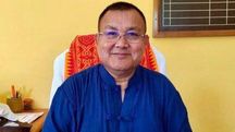
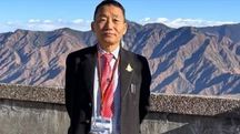
The agreement was signed in New Delhi by Chief Minister of Assam Himanta Biswa Sarma and Chief Minister of Arunachal Pradesh Pema Khandu in the presence of Union Home Minister Amit Shah.
 Key takeaways from the Memorandum of Understanding between Assam and Arunachal Pradesh
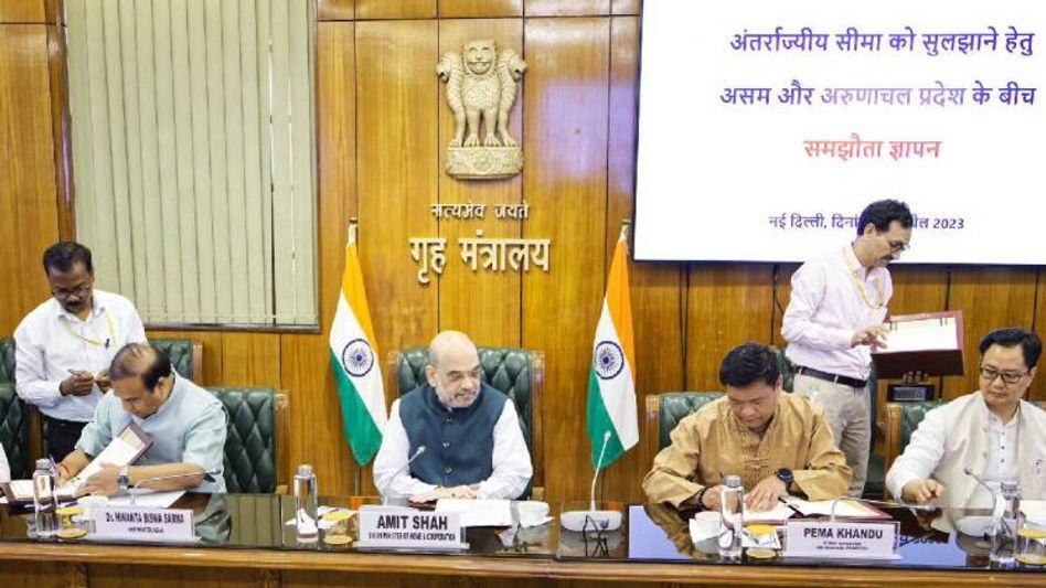
Assam and Arunachal Pradesh on April 20 signed a Memorandum of Understanding (MoU) to resolve the long-standing border dispute, which has been an issue for over five decades.
The agreement was signed in New Delhi by Chief Minister of Assam Himanta Biswa Sarma and Chief Minister of Arunachal Pradesh Pema Khandu in the presence of Union Home Minister Amit Shah.
Here are the key takeaways from the Memorandum of Understanding:
- The purpose of the MoU is to settle the interstate boundary between Assam and Arunachal Pradesh in respect of 123 villages placed before the Local Commission by Arunachal Pradesh.
- The boundary line delineated and signed on the 29 Toposheets by the High Powered Tripartite Committee during the year 1980 would be taken as the notified boundary as the basis for realignment of boundary by both States.
- Both states will constitute 12 Regional Committees covering the 12 districts of Arunachal Pradesh and the 8 counterpart districts of Assam for joint verification of 123 villages and make recommendations to the respective State Governments for delineation of interstate boundary.
- The Namsai Declaration was signed on July 15, 2022, and agreed in principle with regard to 37 villages from the list of 123 villages, with 28 villages remaining with Arunachal Pradesh and 3 villages remaining with Assam.
- The location of 6 villages could not be located on Assam side, and if these villages exist on the Arunachal Pradesh side, they will continue to remain with Arunachal Pradesh.
- The adjustment would now be confined to the remaining 86 villages for delineation of interstate boundary between Assam and Arunachal Pradesh.
- Meetings and consultations: Meetings were held on 02.12.2022, 26.12.2022, and 01.03.2023 under the chairmanship of Union Home Secretary with the Chief Secretaries of both Assam and Arunachal Pradesh. A Chief Minister level meeting was also held on 30.03.2023 in Guwahati to review the progress and resolve unsettled border issues.
- Regional Committees: Regional Committees appointed by both states carried out field visits, inspections, and coordination meetings on several occasions. They submitted their findings and recommendations through Joint Reports.
- Village/area delineation: The MoU specifies the agreed position on the villages/areas in question, including West Kameng, Udalguri, Sonitpur, Bhalukpong, Pakke Kessang, Biswanath, Papum Pare, Kamle, and Lakhimpur. It outlines the agreed boundary lines and areas to be included in Arunachal Pradesh from Sonai Rupai Wild Life Sanctuary and erstwhile Behali Reserved Forest, as well as the exchange of land between the two states.
- Unresolved boundaries: The MoU also mentions unresolved boundaries in certain areas, such as the trijunction of Pakke Kessang, Papum Pare, and Biswanath District involving Radasso river, as well as villages situated in Biswanath and Lakhimpur area of Assam under Papum Pare-Biswanath/Lakhimpur Regional Committees. It emphasizes the need for continuous dialogue and finalization of these boundaries within a period of 6 months by the Regional Committees.
- IAF bombing area: The MoU references survey reports and maps submitted by the Indian Air Force regarding villages situated inside or outside the bombing area in Dullong RF of Assam. It states that villages outside the bombing area will be included in Arunachal Pradesh, and unresolved boundaries will be finalized through continuous dialogue process by Regional Committees within a period of 6 months.
- Villages partially situated inside IAF bombing area: Arunachal Pradesh will take up the matter with the Government of India and Indian Air Force regarding the villages of Midpu, Kherbari, and Rajali that are partially situated inside the IAF bombing area.
- Unhindered right for Indian Air Force: Indian Air Force will have unhindered right to use the entire bombing range.
- Boundary realignment: The boundary between Arunachal Pradesh and Assam will be realigned based on the map prepared, exchanged, and mutually agreed between the Regional Committees for villages such as Deka, Potte, Telam, Telam Camp, New Telam, Kangku, Uli, Upper Borajan, Aditako, Mingmang, Ruti, and Lower Borajan.
- Inclusion of Balisori in Assam: Balisori, along with other areas situated along the interstate boundary inside Arunachal Pradesh but occupied by the people of Assam, will be included in Assam on an "as is where is" basis, as per the map prepared, exchanged, and mutually agreed between the Regional Committees.
- Boundary of Gogar, Jipu, Pale-8, Lika, and Bali: The boundary of these villages, which were settled under the Namsai Declaration, will be decided on an "as is where is" basis as per the map prepared, exchanged, and mutually agreed between the Regional Committees.
- Boundary with respect to Kamcham and Nilok: The Political Road/Forest Road will be the boundary line, including the church area south of the road and agricultural land near Haw river in Arunachal Pradesh.
- Inclusion of Namey village in Arunachal Pradesh: Namey village, along with agricultural land, will be included in Arunachal Pradesh as per the map prepared, exchanged, and mutually agreed between the Regional Committees.
- Realignment of villages: Villages such as New Mingmang, Hime, Germe, Rate, and Siloni Adi will be suitably realigned, segregating the habitations of Torajan Adi villages in Arunachal Pradesh with additional land included in Arunachal Pradesh.
- Clustering of villages: Villages such as Durpai, Champak Chojo, and Sogum situated more than 3 km away from HPTC boundary inside Assam will be clustered in a loop with New Mingmang village, and the area encompassed within the loop will be compensated by exchange of uninhabited equal area from Arunachal Pradesh.
- Inclusion of 9 villages in Arunachal Pradesh: Villages namely Malini, Lipu, Liru, Pale, Dipa, Silli, Silli Ete, Silli Liche, and Kuntor will be included in Arunachal Pradesh up to the habitation and cultivation footprint of the villages as on 24.01.2022, with the boundaries to be finalized within 6 months.
- Inclusion of Lumpo and New Seren H.Q. villages in Arunachal Pradesh: Lumpo and New Seren H.Q. villages will be included in Arunachal Pradesh by making suitable loops to ensure that the BOPs set up by Assam, namely Majulipur and Simenchapori, remain with Assam on an "as is where is" basis, with the boundaries to be finalized within 6 months.
- Inclusion of Wet Rice Cultivation (WRC) land in Sirakhowa cultivated by the people of Depi village, Arunachal Pradesh, as it is adjacent and contiguous to the village area, and inclusion of Mer village in Arunachal Pradesh with a broad contour of the boundary between Assam and Arunachal Pradesh along the boundaries of Mer and Siboguri villages.
- Preservation of areas under Daying Ering Wildlife Sanctuary of Arunachal Pradesh for wildlife conservation only by the state of Assam.
- Inclusion of Keba and Banggo villages in Assam and inclusion of Kaling-1 and Kaling-Il villages partly in Arunachal Pradesh based on the map prepared, exchanged, and mutually agreed between the Regional Committees.
- Inclusion of Paglam village in Arunachal Pradesh and adjustment of the area situated beyond 3 km inside Assam from the interstate boundary with the area of Kaling-l and Kaling-ll villages and area occupied by people of Assam inside Arunachal Pradesh.
- Inclusion of Rukmo village, situated in Kundil Kolia RF of Tinsukia district, Assam, within Arunachal Pradesh up to the habitation and cultivation footprint of the village as on 24.01.2022, and finalization of the same within a period of 6 (six) months, ensuring that no area covered by forest will be transferred.
- Realignment of a portion of the HPTC boundary between Lohit and Tinsukia along the Balijan River and PMGSY road, with an area of 66.079 Hectare (0.6607 sq. km) approximately to be with Arunachal Pradesh from Assam and an area of 170.12 Hectare (1.7012 sq. km) approximately to be with Assam from Arunachal Pradesh.
- Change in a portion of the HPTC boundary between Namsai and Tinsukia to include Mojbari and Thapabari village area of 2.320 sq. km approximately in Assam from Arunachal Pradesh, with the rest of the HPTC delineated Constitutional Boundary to be followed.
- Follow the HPTC boundary and the delineated Constitutional Boundary in the absence of claimed villages in Changlang-Tinsukia, Tirap-Dibrugarh, Longding-Dibrugarh, and Longding-Charaideo areas.
- Inclusion of three villages namely Tanglam Russa, Kamkuh Russa, and Hasse Russa within Arunachal Pradesh up to the habitation and cultivation footprint of the villages as on 24.01.2022 in Longding-Charaideo area, with finalization of boundaries within a period of 6 (six) months, and demarcation of Longkhojan and Ranglua villages, agreed under Namsai Declaration, including the cultivation footprint of these two villages inside Assam as on 24.01.2022 within a period of 6 (six) months.
- Joint assessment of the extent of areas in respect of 11 villages situated beyond 3 km from HPTC line inside Assam and the extent of areas being the temporal expansion of Arunachali villages between 2007 and 2022 inside Assam by ASSAC.
Copyright©2026 Living Media India Limited. For reprint rights: Syndications Today

