Alert: Cyclone ‘Fani’ may have impact on Assam and North East
 Fani
FaniGuwahati, April 29, 2019:
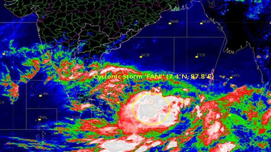
The massive cyclone “Fani” (pronounced “FONI”) has been expected to become stronger and develop into an extremely severe cyclonic storm and move north-westwards till May 1 as stated by the Indian Meteorological Department (IMD).
The storm is currently centered over southeast Bay of Bengal and neighborhood and has moved northwards with a speed of about 4 kmph in last 6 hours.
It is very likely to intensify into a Severe Cyclonic Storm in the next 6 hours and very severe cyclonic storm during the subsequent 24 hours.
It could generate gusts of winds with speeds of up to 50-60 km per hour in the coastal areas of Tamil Nadu and Andhra Pradesh.
A warning has been provided along with coastal areas of Tamil Nadu, Andhra Pradesh and Odisha to brace for very strong winds, heavy rainfall, and rough seas.
As per the IMD reports, the cyclone will move to east-west trough at 0.9 km above mean sea level from east Bihar to Manipur and become less marked. Whereas, a cyclonic circulation at 0.9 km above the mean sea level lies over south Assam and nearby areas.
Speaking to Inside Northeast, Atul Kumar Singh, Scientist, Regional Meteorological Centre Guwahati said that as of now the impact of the cyclone has not reached the region. He also mentioned that effect may come but not immediately.
Copyright©2026 Living Media India Limited. For reprint rights: Syndications Today


