Sikkim scientists map high-risk glacial lakes to assess GLOF threat
A multi-agency team has finished assessing high-risk glacial lakes in North Sikkim's Mangan district. The findings will guide lake-specific GLOF mitigation plans and stronger downstream preparedness.

- Aug 11, 2026,
- Updated Aug 11, 2026, 5:18 PM IST

- The expedition ran from July 23 to August 8 in remote terrain
- Researchers measured lake depth, volume and terrain using multiple survey techniques
- Weather stations at Kerang and Goma Chhu will track high-altitude conditions
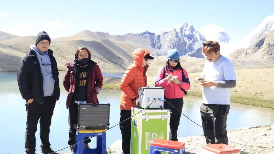
A multi-agency scientific expedition has completed a field assessment of high-risk glacial lakes in North Sikkim’s Mangan district, with the data expected to help authorities identify lakes that could trigger Glacial Lake Outburst Floods (GLOFs) and assess the potential impact downstream.
The expedition, led by the Department of Science and Technology, was conducted from July 23 to August 8 across some of the state’s remote high-altitude areas. The focus was on glacial lake systems already identified as vulnerable to GLOFs — sudden releases of water from glacial lakes that can send large volumes of water and debris into downstream valleys.
The assessment comes as changes in the Himalayan cryosphere raise concerns over the stability and growth of glacial lakes.
Scientists used Electrical Resistivity Tomography, bathymetric surveys to determine lake depth and volume, Differential Global Positioning System (DGPS) surveys, and hydrological and geomorphological assessments during the expedition.
Meteorological monitoring stations were also installed at Kerang and Goma Chhu to collect data on weather conditions in the high-altitude areas.
The information gathered will be used for hydrodynamic modelling and hazard mapping. The aim is to determine the vulnerability of individual lakes and estimate the likely extent of flooding if a lake were to breach.
The expedition involved the Sikkim State Disaster Management Authority, Department of Mines and Geology, Sikkim University, Sikkim Commission on Glacial Hazards, C-DAC Trivandrum, Central Water Commission and Brahmaputra Board, along with technical partner Campbell Scientific.
The Indian Army and Indo-Tibetan Border Police supported the team in accessing difficult terrain and high-altitude locations.
The findings are expected to form the scientific basis for lake-specific Comprehensive GLOF Hazard Mitigation Plans. These plans will help authorities strengthen early-warning mechanisms, monitoring systems and preparedness in areas that could be affected by a glacial lake breach.
For Sikkim, where several high-altitude lakes are located above vulnerable valleys and infrastructure, the assessment is aimed at moving GLOF preparedness from broad risk identification to lake-specific planning.