Assam floods: Satellite images reveal Brahmaputra's floodplain expanding nearly threefold
At least 47 people have lost their lives as Assam grapples with one of its most severe flood crises in recent years.
- Jul 24, 2026,
- Updated Jul 24, 2026, 2:21 PM IST
At least 47 people have lost their lives as Assam grapples with one of its most severe flood crises in recent years.
According to the latest report from the Assam Disaster Reporting and Information Management System (DRIMS), more than 7.21 lakh people across 11 districts and nearly 900 villages remain affected. Six of the fatalities were reported in the last 24 hours alone. Chief Minister Himanta Biswa Sarma has also warned that around 40 people are still missing and the death toll could rise further.
The disaster was triggered by exceptionally heavy rainfall in the upstream hill catchments of Nagaland and Arunachal Pradesh, coupled with intense rainfall across Upper Assam. The sudden inflow of water inundated districts that have rarely witnessed flooding of this magnitude. Data from the India Meteorological Department (IMD) showed that Charaideo received 170 mm of rainfall — 436 per cent above normal — while Golaghat recorded 147.9 mm, Jorhat 105.2 mm and Sivasagar 93.2 mm during the period.
Unlike the routine monsoon swelling of the Brahmaputra, this flood saw water spilling into villages, tea estates and settlements that residents say had remained largely unaffected for decades. Tributaries such as the Dikhow, Disang and Janji overflowed dramatically, carrying floodwaters far beyond their normal courses and causing widespread devastation across Upper Assam.
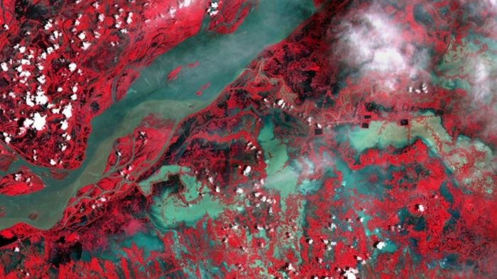
Satellite imagery from the European Union's Copernicus Earth Observation Programme illustrates the scale of the flooding, showing vast stretches of the Brahmaputra valley submerged from Goalpara and Guwahati to Nagaon, Jorhat and eastern Assam.
Near Jorhat, satellite analysis indicates that the apparent flood corridor expanded to nearly 21 kilometres — almost three times its normal visible extent. The widening reflects floodwaters spreading across sandbars, agricultural land and nearby settlements, rather than the width of the Brahmaputra's permanent river channel.
A separate flood-extent analysis by the Indian Institute for Human Settlements' Global Flood Mapper also highlights extensive inundation across the valley. Using Sentinel-1 radar imagery, the system compares pre-flood conditions with current satellite observations to identify abnormal water spread. The maps provide an indicative picture of the flood's extent and complement official ground assessments.
Sivasagar remains the worst-affected district, with nearly 3.92 lakh people impacted, followed by Charaideo with around 1.10 lakh and Jorhat with close to 97,700 affected residents. Floodwaters have submerged approximately 25,375 hectares of agricultural land, while over 24,000 people are currently housed in relief camps. More than 1.39 lakh livestock have also been affected.
River gauge data continues to paint a grim picture. The Burhidihing at Chenimari-Khowang, Dikhow at Sivasagar, Dhansiri South at Numaligarh and Kushiyara at Sribhumi remain above the danger mark, while the Disang at Nanglamuraghat has crossed its previous highest flood level, underscoring the exceptional nature of the flooding across Upper Assam.
The situation remains precarious as the India Meteorological Department has forecast heavy rainfall, thunderstorms and lightning across Assam and Meghalaya until July 30, raising concerns that already saturated river basins could witness renewed flooding in the coming days.
Inputs from India Today