Beyond the Bulletin: Assam’s Flood Real Time Dashboard
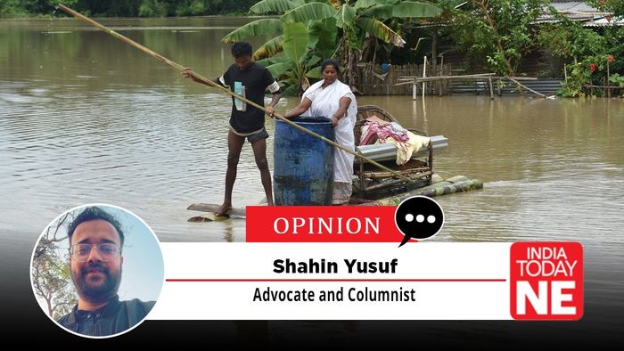
In recent flood alone, over 5.24 lakh people, 1.39 lakh livestock, 856 villages inundated under 37 revenue circles across 27 districts were affected, with more than 66 human lives lost and over 100,000 hectares of crops destroyed. Yet amid this annual cycle of devastation, one question persists: does our flood dashboard truly capture the lived reality of the affected people, or does it remain a district level abstraction, blind to the village?
- Jul 27, 2026,
- Updated Jul 27, 2026, 7:44 PM IST
Every monsoon, Assam braces for a recurring calamity. Rivers swell, embankments give way, hills crumble into landslides, cattle perish, and villages vanish beneath floodwaters, prompting relief operations in haste.
In recent flood alone, over 5.24 lakh people, 1.39 lakh livestock, 856 villages inundated under 37 revenue circles across 27 districts were affected, with more than 66 human lives lost and over 100,000 hectares of crops destroyed. Yet amid this annual cycle of devastation, one question persists: does our flood dashboard truly capture the lived reality of the affected people, or does it remain a district‑level abstraction, blind to the village?
Assam is not beginning anew, the flood phenomenon has shadowed us from pre‑colonial times to the present. Colonial gazetteers recorded the Brahmaputra’s inundations as early as the 19th century, and the 1929 Surma–Barak Valley Flood Committee investigated one of the heaviest floods in Sylhet and Cachar. Despite this long history, owing to our lahe‑lahe disposition, we continue to lag behind in many sectors of flood relief and preparedness
The Disaster Management Act, 2005 already entrusts the Assam State Disaster Management Authority (ASDMA) and District Disaster Management Authorities, chaired by Deputy Commissioners under Section 25, with coordinating disaster response and disseminating critical information. Between 2020 and 2021, ASDMA, in partnership with UNICEF, developed a real-time flood reporting system featuring GPS-enabled field reporting, offline data collection for remote areas, multilingual forms, and integration with rainfall forecasts, river-level data and early warning systems. The foundation therefore exists. What remains unfinished is the last and most crucial step: ensuring that this information is not merely compiled, but made useful for those delivering relief and, above all, for those receiving it.
Every day, ASDMA publishes flood bulletins showing the number of affected districts, villages and displaced persons. These updates are valuable per se, but they stop where the real challenge begins. They do not answer the questions relief workers, NGOs and citizens urgently need answered: Has a particular village/town already received food and water? Is safe drinking water available? Does another village/town require medicines, tarpaulins or cattle feed? Which villages/towns remain completely unreached even after 48 hours? How many boats are currently deployed in each affected circle? Which villages remain unreached due to lack of boat access?
The absence of such real time data information often results in avoidable inefficiencies. Relief organisations and social media influencers naturally gravitate towards locations that are easier to access or already visible through media coverage, while remote villages may wait for days before assistance arrives. Even well-intentioned NGOs, corporate CSR teams and volunteer groups frequently work in isolation because no verified, real-time platform indicates which villages have already been covered and which continue to require immediate assistance. The issue is therefore not merely one of resources, but of coordination.
The solution need not involve creating another portal or spending heavily on new technology. It should build upon the system that already exists.
The proposed Assam Flood Relief Coordination Dashboard should be governed within the existing institutional framework established under the Disaster Management Act, 2005, without creating any new authority. At the apex, the State Executive Committee (SEC), constituted under the Act, should issue an executive order authorising the Assam State Disaster Management Authority (ASDMA) to implement and manage the dashboard. As the nodal agency, ASDMA would own the platform, maintain the central database, integrate real-time information from the State Emergency Operation Centre (SEOC), the India Meteorological Department (IMD), the Central Water Commission (CWC), NESAC’s Flood Early Warning System (FLEWS), and other relevant agencies, while also publishing a simplified public-facing dashboard that protects the privacy of affected individuals.
At the district level, the District Disaster Management Authorities (DDMAs), chaired by the respective Deputy Commissioners under Section 25 of the Disaster Management Act, would be responsible for verifying real time data information, coordinating relief efforts, approving NGO assignments where necessary, and ensuring that data uploaded to the platform accurately reflects ground conditions. District Emergency Operation Centres (DEOCs) would monitor field operations and coordinate with Circle Officers, Block Development Officers, and line departments such as Health, Public Health Engineering, Veterinary, Public Works and Power to ensure timely updates and effective resource deployment.
Real time data information would be collected through authorised field functionaries, including Ward Councillors in town, Gaon Pradhans in villages, Panchayat Secretaries, ASHA workers, Anganwadi workers, lot Mandals, Village Defence Parties and trained volunteers using GPS-enabled mobile applications capable of offline data capture in areas with poor connectivity. This stage is very important and the first point of contact with the flood victims. Their reports would be verified at the district level before being reflected on the public dashboard to maintain reliability and prevent misinformation.
Registered NGOs, corporate CSR teams, voluntary organizations and individuals would receive controlled access to a coordination module through which they could identify unreached villages, digitally undertake responsibility for relief operations in a particular village, and upload geo-tagged and time-stamped proof of relief distribution. Once a village is assigned, it would temporarily be marked as allocated to minimise duplication while allowing district authorities to retain overall supervisory control.
The platform should also incorporate a robust accountability framework. The Chief Secretary may chair periodic review meetings during the flood season, while the Principal Secretary of the Revenue and Disaster Management Department and the Chief Executive Officer of ASDMA oversee policy implementation and operational management. Deputy Commissioners would remain accountable for district-level data accuracy and response coordination. Periodic technical audits by institutions such as IIT Guwahati, along with independent social audits and a public grievance mechanism allowing citizens to report discrepancies between dashboard data and actual relief received, would further strengthen transparency and public confidence.
Flood relief in Assam must go beyond food packets and tarpaulins. The lived realities of affected communities demand that female hygiene essentials: sanitary pads, personal hygiene kits, and inner wear to be incorporated into standard relief materials. Neglecting these needs leaves women and girls vulnerable to health risks and indignity during prolonged displacement.
At the same time, floods displace not only people but also pet animals. Many are left without owners, wandering in relief camps or marooned villages. A humane relief framework should include a dashboard feature for pet adoption, enabling citizens and NGOs to track, rescue, and adopt stranded animals.