How not to destroy what makes Kaziranga exist
Shrinking Kaziranga’s buffer from 10 km to 1 km could endanger wildlife corridors, flood escape routes and fragile habitats. The answer is not to block development, but to let an independent scientific study decide how much protection Kaziranga actually needs.
- Aug 29, 2026,
- Updated Aug 29, 2026, 1:25 PM IST
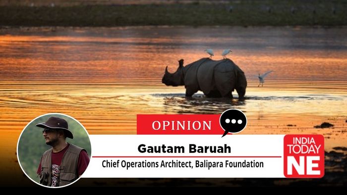
Every monsoon, the Brahmaputra does to Kaziranga what it has always done. It swells, spills over the grasslands, and turns a great deal of the park into water. The rhinos, elephants, buffalo and deer inside it then do the only thing they can. They head for higher ground.
They cannot go north. The river is there. Their one escape route is south, across NH-715, the road most of us still call NH-37, through nine recognised corridors into the Karbi Anglong hills. Panbari, Haldibari, Amguri, Kanchanjuri, Deosur, Bagori, Harmati, Hatidandi, Chirang. That's it. That is the list. There is no alternative arrangement, no second option somebody can build later.
Keep that picture in your head, because a proposal is now on the table to shrink the Eco-Sensitive Zone around Kaziranga from 10 km to 1 km, and the argument against it isn’t sentimental. It’s geographical.
What 10 km actually means
Kaziranga does not yet have a final, site-specific ESZ of its own. In the absence of one, the Supreme Court’s June 2022 order applies a default 10-km buffer around protected areas across the country, and the Gauhati High Court confirmed as recently as March 2026 that this default still governs Kaziranga. The proposal to bring it down to 1 km comes with a stated purpose—easing restrictions on development in the towns around the park, including a stadium planned at Bokakhat. No formal proposal has gone to the Centre yet, and any draft notification would have to go through public consultation. Which is exactly why it is worth talking about now, while the thing is still being thought through.
Here’s the part that gets lost when people hear “10 km to 1 km” and mentally file it as a modest trim. That 10 km is not a line on a map. It is a ring, 10 kilometres deep, running the entire length of the park’s boundary. The area of a ring like that rises with its depth. So cutting it to 1 km doesn’t shave a 10th off the protection. It removes something close to nine-tenths of the protected land around the park, in one go, along the whole perimeter.
That is a very large decision to take administratively, without a study.
A buffer isn’t decoration
An Eco-Sensitive Zone does unglamorous work. One of its jobs is to keep village cattle and free-ranging animals at some distance from wild herds, which keeps disease from moving between the two.
This is not a hypothetical worry dressed up as science. Africa spent the better part of a century with rinderpest, a cattle disease that tore through wild buffalo and wildebeest across the Serengeti-Mara whenever domestic and wild herds mixed closely. It was declared eradicated worldwide only in 2011. Narrow the buffer and you multiply the points where Kaziranga's herds and village cattle meet. That is a real risk, currently kept low, that we would be choosing to raise.
Buffers also absorb what ecologists call the edge effect, the noise, light, human presence and disease exposure that degrade a habitat from its boundary inward before they ever reach the core. The damage from losing that cushion is slow and undramatic. You usually notice it after it has compounded for years.
We built this over a hundred years
Kaziranga became a reserve forest in 1905, when perhaps a dozen rhinos were left in the area. What followed was not luck. It was decades of dull, dogged protection work. A.J. Milroy, the British forester who compiled the 1934 survey Game Preservation in India: Assam, put a platoon of Assam Rifles into Manas Reserve Forest in the 1930s to stop rampant rhino and elephant poaching, and it was Milroy who first opened Kaziranga to visitors in 1938, working alongside Mahi Chandra Miri and, later, E.P. Gee.
Look at what that patience bought. Rhinos went from 1,552 in 1999 to 2,613 in the 2022 census, over a thousand more animals in barely two decades, and nearly two-thirds of the world’s wild rhino population. Elephants are now above 1,200. Tigers rose from 104 in 2022 to 148 in the 2024 census, among the highest densities recorded anywhere on earth. The wild water buffalo, over 2,500 of them, are the largest such population left. The park is an Important Bird Area with 479 recorded species, and its wetlands hold more than 20,000 waterbirds at peak season.
Now the consequence nobody likes to say out loud. More animals need more grass, more water and more room. An adult rhino eats roughly 150–200 kg of grass and forage a day and drinks 100–150 litres, quite apart from what it needs to wallow. An adult elephant eats about 150 kg and drinks 150–190 litres. Multiply that across Kaziranga’s present numbers and you are looking at several hundred tonnes of forage and several lakh litres of water a day, drawn from grasslands that cover about 57 per cent of the park (52 per cent tall grass, 5 per cent short grass and marsh) and wetlands that make up another 7 per cent, fed by the beels. It’s a rough estimate, but it makes the scale concrete. A buffer policy that ignores this can quietly undo, over 20 years, the recovery it was meant to protect. And the animals nobody photographs, the critically endangered pygmy hog, for one, live or die by how well that same grassland base holds up.
The other side of the same century
The people around Kaziranga have grown in number just as dramatically, and it would be dishonest to leave that out. Golaghat town had a little over 2,000 residents in the early 1910s and roughly 42,000 by 2011. Golaghat district crossed a million (1,066,888) by then. Bokakhat subdivision, which runs right along the park's southern and eastern edge, recorded over 145,000 residents across its villages by the 2011 census, up from a thin, largely forested frontier population when the reserve was first declared.
None of that growth is illegitimate. People have every right to live, farm and build a life on that land. But any policy must consider both sides. Wildlife needs more space and resources, while the human population around the park is also growing. You cannot look at one and ignore the other. Both need to be studied together.
And there is one honest complication. Around Sekoni and Bokakhat town, built-up development already stands less than a kilometre from the park boundary, before any change to the ESZ. Nobody is suggesting those homes be disturbed. But that shortfall is a reason to study the problem properly and regularise or mitigate it case by case. It is not a precedent for shrinking protection along the entire boundary.
While we’re here, let’s define terms. “Development” in this argument means unregulated, unplanned activity inside the buffer including hotels, resorts and commercial establishments, farmland and forest land flipped for real estate, quarrying and mining, tourism infrastructure and traffic and waste that fragment the corridors. It does not mean roads, schools, health facilities or the wildlife-friendly highway works already under way. The quarrel is with the pace and location of unplanned commercial construction near the boundary, not with development itself.
Somebody should just count
Here is what surprises most people. We do not actually know Kaziranga’s carrying capacity, the maximum wildlife population its grasslands, wetlands and water can sustain, and how that ceiling moves with rainfall, temperature and flood. Published rhino-habitat research on Kaziranga has said plainly that there is no detailed suitability map and no established carrying-capacity values for the park. Meanwhile census officials have wondered aloud whether the slowing growth in recent rhino counts is an early sign that parts of the park are nearing that ceiling.
That’s a strange gap to have in a park we discuss this confidently. A dedicated study, distinct from the safari-tourist carrying-capacity work already going on, would replace inference with evidence.
It would also have to model flooding, because for a floodplain park you cannot separate the two. Kaziranga has never had a formal buffer of its own, which means its animals have always relied on the highlands beyond the boundary as flood refuge. That is precisely why several of the park’s recent additions, notified through the 2010s and 2020s, were created as highland refuge, after years in which animals died trying to cross roads and railway lines to reach higher ground. IUCN’s assessors have flagged that climate change is expected to intensify exactly these flood pressures.
And the study should not stop at the park’s fence. Kaziranga isn’t an island. Its western additions, including the Sixth Addition on the Sonitpur/Biswanath side, adjoin a riverine and grassland corridor that conservationists and the Assam government have been building out to link Kaziranga through Laokhowa and Burachapori to Orang, and further along to Pobitora. Rhinos, tigers and elephants have already been recorded moving along it. A study confined to Kaziranga’s own boundary would miss all of that.
Two examples, one lesson
Nepal faced this same squeeze at Chitwan and answered it with a Buffer Zone Policy in 1996 that shares 30–50 per cent of park revenue with the communities living around it and gives them a formal role in managing the buffer forest. Paired with hard anti-poaching work, it helped Chitwan’s rhinos and tigers recover substantially. There’s a nice piece of history in this. E.P. Gee, the Assam tea planter and naturalist tied to Kaziranga’s own conservation story, was among those who first recommended creating what became Chitwan.
Thailand shows the other outcome. A national highway was pushed through the Dong Phayayen–Khao Yai Forest Complex without a proper external buffer. Encroachment followed, wildlife movement broke down, and fixing it afterwards took a US $40-million corridor retrofit finished only in 2019. Protecting a buffer at the start is far cheaper than rebuilding connectivity once it’s gone.
Tourism needs the park to survive first
This is not an argument against tourism or Bokakhat’s development. Tourism is one of the strongest economic multipliers this region has. But it works only if it sits on an ecology that keeps growing rather than one being drawn down.
What we need is a clear tourism policy that protects sensitive areas while allowing local people to benefit. Hotels and commercial activity should follow firm rules, major new tourism projects should be kept away from the most fragile zones, and community-based tourism should get priority so that more of the income stays with people living around Kaziranga. The park’s natural asset base is what makes the tourism economy possible at all. Erode the asset and the economy goes with it.
What should happen next
Nothing here asks for the proposal to be rejected out of hand. It asks for the number to be earned rather than assumed.
Commission an independent, landscape-level scientific study of the ESZ, with the committee constituted within 90 days, to fix the appropriate buffer width for Kaziranga and other important forest landscapes in Assam. Under the same mandate, run a dedicated carrying-capacity study for Kaziranga and its successive additions, explicitly modelling weather, climate and Brahmaputra flood patterns and assessing connectivity to Laokhowa, Burachapori, Orang and Pobitora. Until that’s done, hold the 10-km buffer as an interim measure. Assess the handful of places like Sekoni and Bokakhat town where development already sits under a kilometre from the boundary, and regularise or mitigate them scientifically instead of treating them as precedent. Enforce real rules on solid waste and greywater around the periphery, particularly at Kohora. Protect the water bodies within 25 km. Stop the unregulated quarrying in and around the ESZ. Publish the tourism policy. And where habitat or corridors have already been degraded, restore them, relocating incompatible activity where the science says it’s necessary.
This was never development versus conservation. It’s about not destroying the system that makes Kaziranga, and everything Kaziranga earns for Assam, possible in the first place. Let the park stay connected. Let its animals keep their ancient road to safety.
And let the width of that buffer be settled by a study, not a signature.